This offline line map is really good, I downloaded the map for the state of Sonora and Baja and it has a great map of Penasco as well as the new road to San Carlos through Puerto Libertad so you don't have to go through Caborca and Hermosillo. A nice to have so you don't have to use roaming data on your U.S. phone while in Mexico. Free if you use the code tvmedia and follow the directions on the link.
I have done the trip to San Carlos the back way....You still have to go through Hermosillo. - you can trust the map that you downloaded or you can look at the road log we created 2 weeks ago on a physical km by km (actually mi x mi) trip just for that purpose.
I do this so that we don't have people running around in the desert in August looking for a road that does not have a sign. Don't get lost! This path may not be the best for everyone but it is an adventure and we love adventures! Don't trust everything you read on the internet!
Russ a few miles past Miguel Aleman there is an intersection where you can make a right turn (there are signs but I can't remember what they said), that road goes straight to the 15, and puts you about 30 or so miles North of San Carlos on the 15. There is a Pemex/Oxxo on the northwest corner of this road and the 15. This route bypasses Hermosillo and saves about an hour depending on the potholes which were bad the last time I took it in May of last year. The road is fairly heavily traveled and is maybe 40-50 miles or so until you reach the 15. Good road for an adventure on the way to San Carlos for sure.
Yes I know the agric road very well. It is not marked (at all) and not part of our road log. The Agric section of our log (the Hermosillo part) would scare away most people looking for a day drive but it is there and fun for sure. The story out there is that the road between Kino and El Deseboque de los Seris is paved (it is) , then from Seris to the road just south of Puerto Libertad is under construction and we will soon be able to get to Kino Bay without going through the Agric fields. Thank you very much for the post I am sorry that I intervened but I don't want people to get the wrong idea, it is not a picknic drive, you have to want to do it!. By the way I want to do it, and I have , and I love it! Adventure awaits! Be prepared.
Russ Sez: The story out there is that the road between Kino and El Deseboque de los Seris is paved (it is) , then from Seris to the road just south of Puerto Libertad is under construction
Sorry to be so dense, but: What road are you referring to between Kino and El. Des that is paved. The final leg to Kino is the old road from Puerto Liberdad at this time, correct? Does the newly paved highway end at Liberdad?
I have taken that cut off to go from Kino to San Carlos several times, It ain't that bad.:-):-)
The new highway ends at Libertad, the road from Libertad to Hermosillo has been there a long time. Libertad produces electricity and so parts and other supplies come from Hillo. South of Libertad towards Hillo there is currently a dirt road to Desemboque de los Seris. That road/trail is being paved and will continue the new coastal highway to Kino, through Des. I am excited to see when this is done. Peñasco to Kino 4 hours almost all along the coast!
Mmmmm so there is new road direct between Kino and El Des, and it is paved ? The story out there is that the road between Kino and El Deseboque de los Seris is paved (it is)
I am aware that there are 2 Desemboques having visited both as well a Punto Cheka. I confused my imagery memory of the condition of the two roads to the upper coast pair, thinking that one could take the coastal highway to Libertad, then shoot over to El Des. and connect up with the reportedly paved road down to Kino.
The question still remains: Is there a newly paved road from Kino to El Des?
The road from Kino Bay to Punta Chueca (el Desemboque de los Seris) is paved from what I was told at the Pemex at the end of the old road North of Kino where the new roundabout is - where the million dollar homes are built in a private gated community near the northern most boat launch an the other side of New Kino to the North. It is impressive.
Well there's the confusion. There are two Desemboques but Punta Chueca is not one of them. They are three seperate communities. El Desemboque de los Seris is quite a bit north of Punta Chueca. That's what had me confused. So it sounds like the road from Kino to Punta Chueca may be paved at least in part.
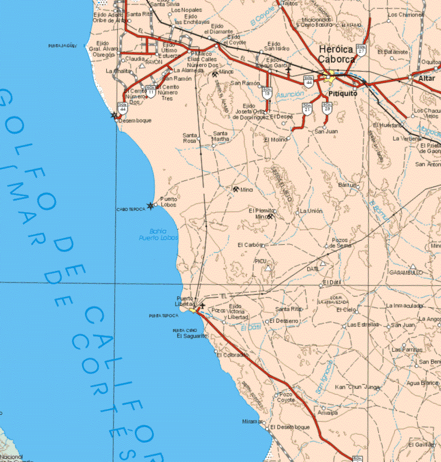
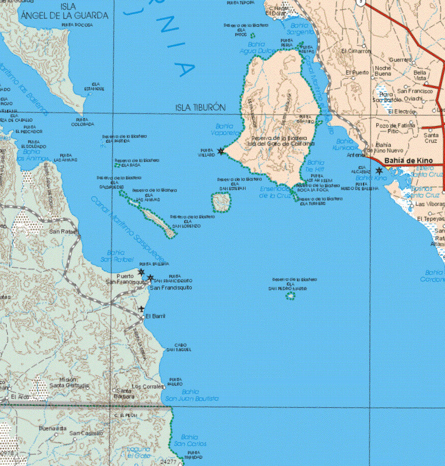
The map above clearly shows the location of the two Desemboques, far north of Kino. While this map does not show Punta Chueca , it is just north of Kino and on the coast across from Isla Tiburon. It's a very small settlement where you can get a tour to Tiburon. Hope this clears up the confusion. The Seris from P.Chueca work the tourists in Kino. If the new highway goes througn Chueca it will have a huge impact on this isolated area.